Photo-ID & Population Monitoring
Identify individual sharks, dolphins, turtles, or whales using markings, fins, flukes, scars, and encounter records.
Join real research missions shaped by telemetry, camera-trap monitoring, anti-poaching patrol support, and biodiversity surveys. Work alongside active researchers and conservation teams, with meaningful field science open to anyone ready to contribute.
Telemetry fixes, spoor, camera-trap returns, nest activity, reef transects, and vessel-based sightings.
Species presence, behaviour, GPS points, habitat condition, patrol notes, threat indicators, and weather.
Support anti-poaching patrols, biodiversity baselines, marine monitoring, restoration checks, and field logistics.
Help turn field observations into useful data for researchers, rangers, reserve teams, and conservation partners.
These programmes are designed for students and conservation-minded travellers who want to understand how marine ecosystems are monitored in the real world. Depending on location and season, you may help collect species records, survey habitats, organise field data, and support local conservation teams.
Boat days, reef surveys, beach patrols, and wildlife encounters depend on permits, weather, sea state, partner priorities, animal welfare, and seasonal movement. The value is in useful contribution, not staged sightings.
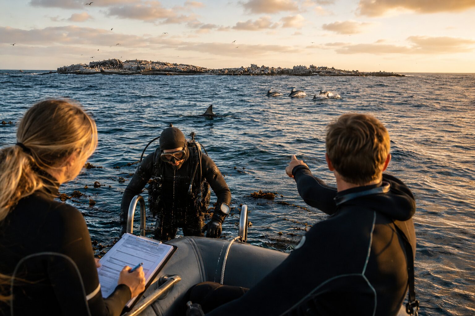
Gansbaai's Dyer Island ecosystem is one of Africa's richest marine field classrooms: shark waters, whale migration routes, Cape fur seal colonies, African penguin breeding habitat, dolphins, seabirds, and working marine research boats in one compact coastal base.
This is a strong fit for marine biology, zoology, veterinary, ecology, and gap-year participants who want a concentrated coastal research base. The area has a world-famous great white shark research history, while current shark work may also focus on bronze whalers, rays, and wider predator-prey change.
Identify individual sharks, dolphins, turtles, or whales using markings, fins, flukes, scars, and encounter records.
Record species presence, group size, behaviour, GPS locations, weather, sea state, and human activity from research vessels.
Survey coral cover, bleaching, reef fish, invertebrates, algae, substrate, and reef disturbance using transects or photo-quadrats.
Monitor turtle tracks, nests, hatchling emergence, beach erosion, artificial light, predator disturbance, and strandings.
Support mangrove, seagrass, reef, or seabird-habitat work through mapping, survival checks, nursery support, and field records.
Clean field sheets, catalogue images, prepare simple summaries, and help turn conservation observations into usable records.
Gansbaai, Dyer Island, Hermanus, and Cape Agulhas as a compact marine research corridor.
A flexible island programme combining coral reefs, turtles, seagrass, mangroves, dolphins, and community fisheries.
Walvis Bay, Pelican Point, and Cape Cross as an extension to desert wildlife work.
Research is never a fixed showreel. It follows animal movement, weather, sea state, visibility, nesting cycles, patrol schedules, vegetation cover, and the questions our partners are actively trying to answer.
June to December is the strongest window for southern right whale monitoring, with boat-based observations shaped by sea state. Shark, ray, seal, penguin, dolphin, seabird, strandline, and marine-debris work can continue across the year, with daily tasks shifting between vessel surveys, coastal watches, photo-ID, and data capture.
Reef, seagrass, mangrove, fisheries, plastic, and community research can run through much of the year, with underwater work strongest when visibility and currents allow. Turtle nesting, hatchling checks, strandings, and beach patrols are matched to local partner sites, so dates should be chosen around the field question you care about most.
Namibia works best as a coast-and-desert research add-on: desert telemetry, camera-trap checks, human-wildlife conflict notes, and spoor observations can link with Walvis Bay lagoon counts, Cape fur seal monitoring, dolphin observations, strandline surveys, and fog-fed coastal ecology. It is a strong choice for people interested in how land, ocean, and climate connect.
Camera traps, telemetry, biodiversity surveys, anti-poaching patrol support, and reserve monitoring change with rainfall, heat, access, breeding seasons, and vegetation density. Dry periods can make tracks, water points, and wildlife movement easier to read; greener months can be better for birds, plants, insects, and broader ecosystem surveys.
We can help match your interests to the best field base: Marine Big 5 in South Africa, reef and turtle ecology in Zanzibar, or a Namibia coast-and-desert add-on.